Meine Projektions-Kollektion:
Kartenprojektionen vergleichen
Natural Earth II vs. Winkel Tripel
| Natural Earth II | Winkel Tripel | |
|---|---|---|
| Urheber | Tom Patterson, Bojan Savric, Bernhard Jenny (2015) | Oswald Winkel (1921) |
| Gruppe | Pseudozylinder | Lentikulär |
| Eigenschaft | Vermittelnd | Vermittelnd |
| Andere Namen | — |
|
| Anm.Anmerkungen | The Natural Earth II is a new pseudocylindrical projection with a highly rounded shape. At high latitudes the meridians bend steeply inward to short pole lines. Compared to other rounded projections, such as the Aitoff and Mollweide (…), the Natural Earth II bulges out less on the sides, filling more of the printed page with your map. Continents look familar without the north-south streching found on the Eckert IV. The Natural Earth II has areal distortion values similar to those of the popular Robinson and Winkel Tripel projections. (Zitiert von der Vorstellung der Projektion) Nicht zu verwechseln mit dem Natural Earth II Kartenbild (ebenfalls Tom Patterson), welches hier auf der Website für fast alle Projektionen verwendet wird. |
— |
| Empfohlene Vergleiche | Aitoff Eckert IV Mollweide Robinson Winkel Tripel Natural Earth |
Ciric I Natural Earth II Wagner IX.i Winkel Tripel Bartholomew Winkel Tripel BOPC |
|
Diese Paarung gehört zur Liste der empfohlenen Vergleiche – aber warum? Als Natural Earth II vorgestellt wurde, haben die Urheber ebenfalls diese Paarung gezeigt. |
||
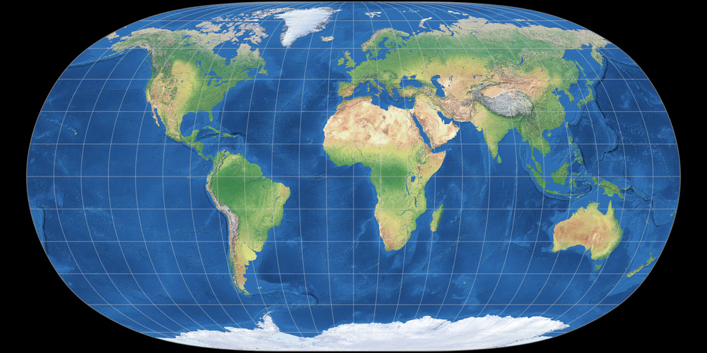
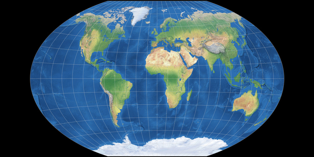
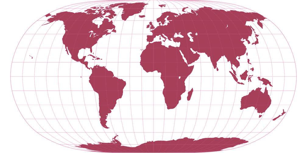
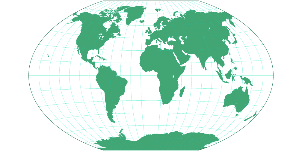
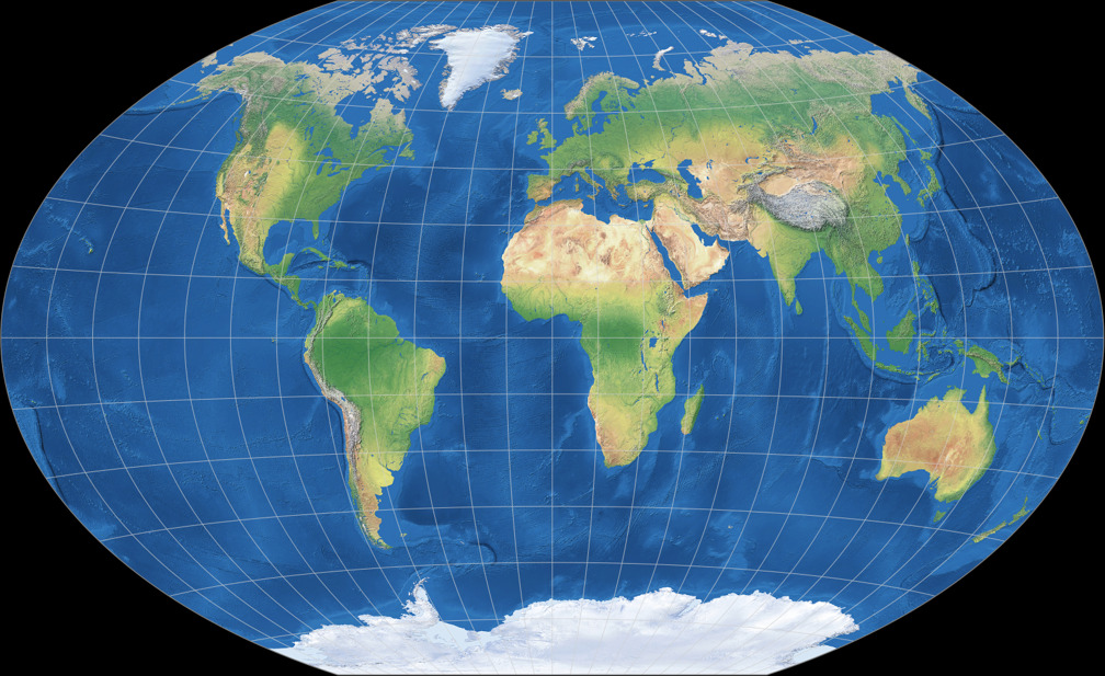
1. Vergleich: Physische Karte – passend skaliert
Natural Earth II
Winkel Tripel
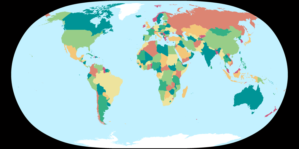
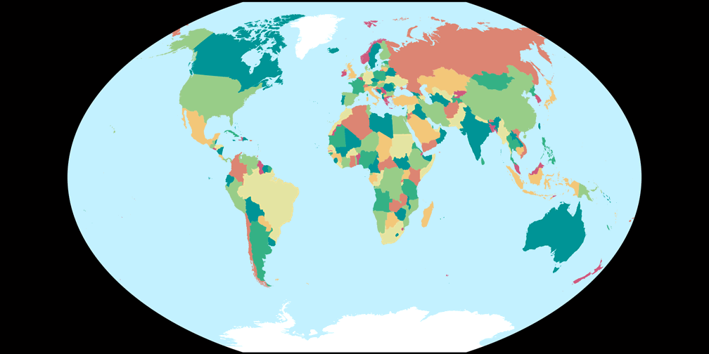
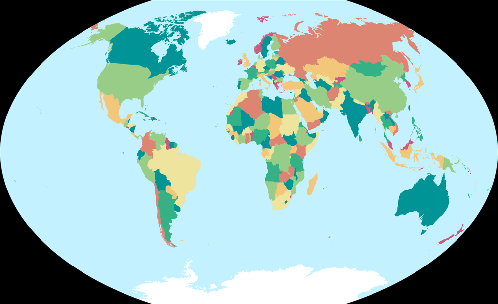
2. Vergleich: Politische Karte – passend skaliert
Natural Earth II
Winkel Tripel
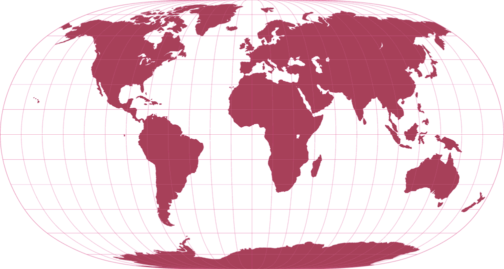
3. Vergleich: Umrisskarte – passend skaliert
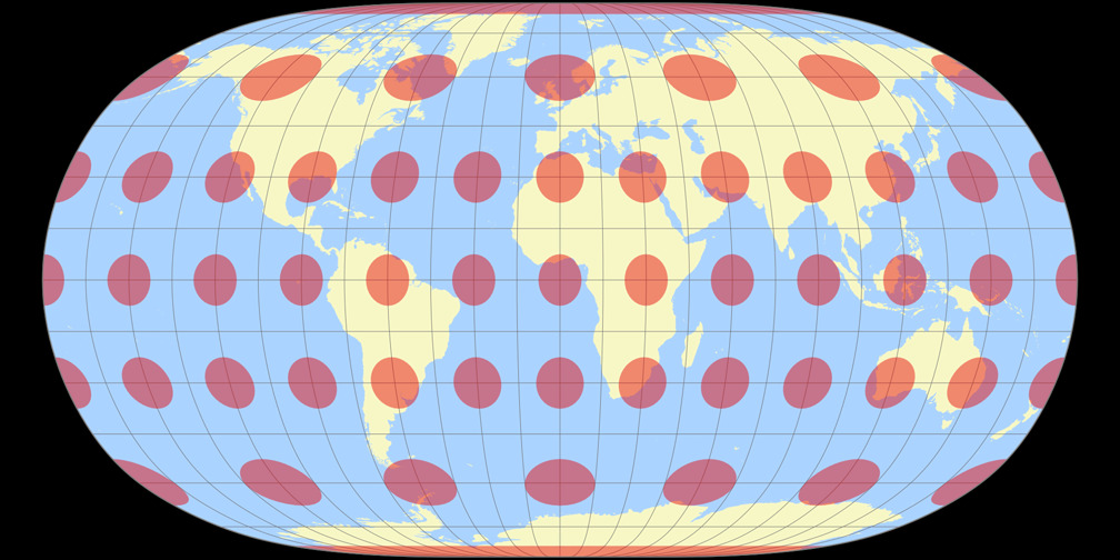
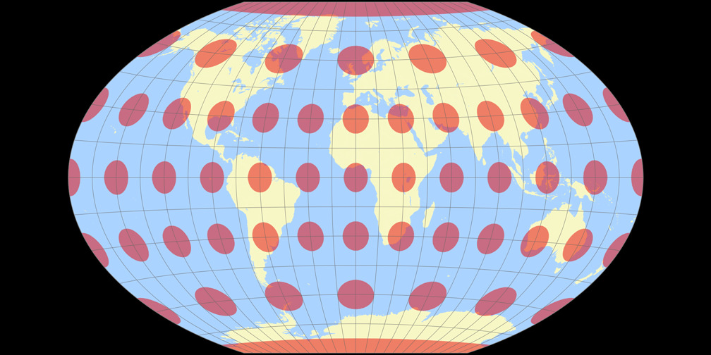
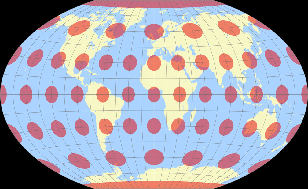
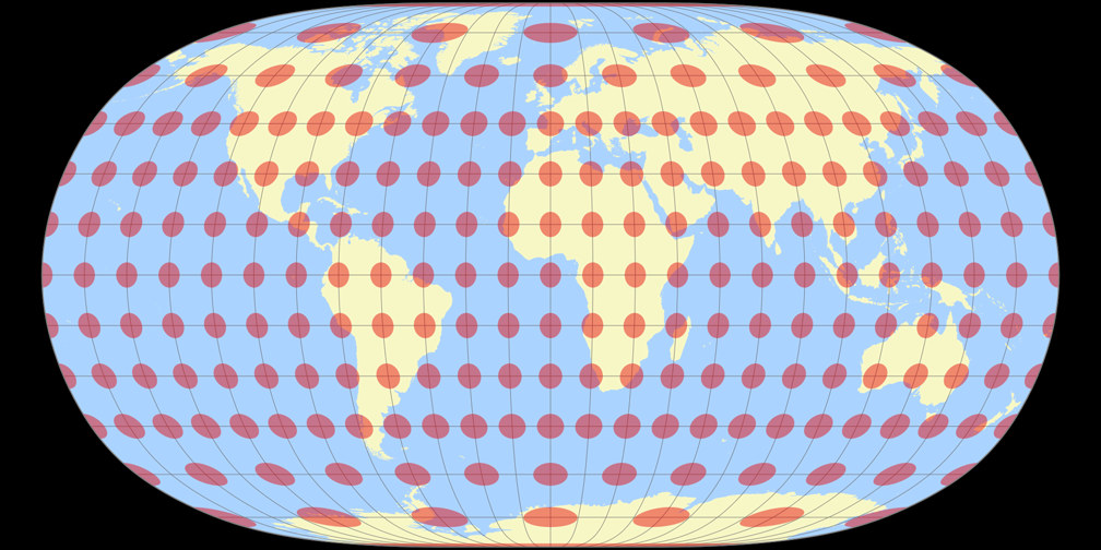
4. Vergleich: Tissotsche Indikatrix, 30° – passend skaliert
Natural Earth II
Winkel Tripel
Natural Earth II Tissotsche Indikatrix c Tobias Jung
Winkel Tripel Tissotsche Indikatrix c Tobias Jung
5. Vergleich: Physische Karte – auf gleiche Breite skaliert
Natural Earth II

Winkel Tripel
6. Vergleich: Politische Karte – auf gleiche Breite skaliert
Natural Earth II

Winkel Tripel
7. Vergleich: Umrisskarte – auf gleiche Breite skaliert

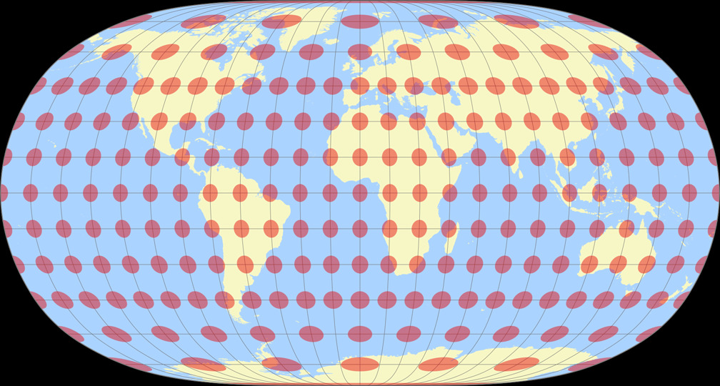
8. Vergleich: Tissotsche Indikatrix, 30° – auf gleiche Breite skaliert
Natural Earth II

Winkel Tripel
Natural Earth II Tissotsche Indikatrix c Tobias Jung
Winkel Tripel Tissotsche Indikatrix c Tobias Jung
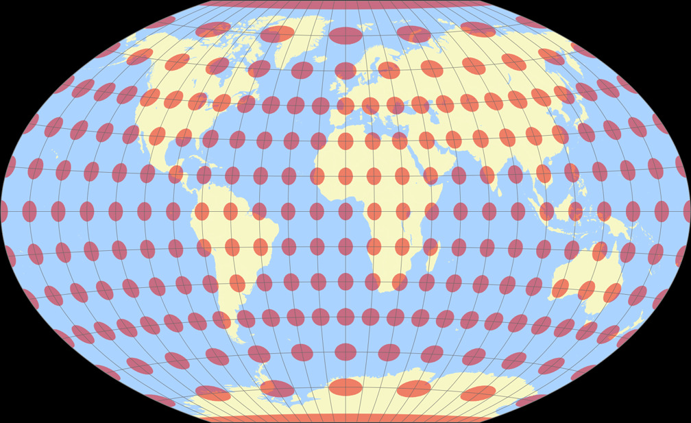
9. Vergleich: Tissotsche Indikatrix, 15° – passend skaliert
Natural Earth II
Winkel Tripel

Natural Earth II Tissotsche Indikatrix c Tobias Jung
Winkel Tripel Tissotsche Indikatrix c Tobias Jung
10. Vergleich: Tissotsche Indikatrix, 15° – auf gleiche Breite skaliert
Natural Earth II
Winkel Tripel
Natural Earth II Tissotsche Indikatrix c Tobias Jung
Winkel Tripel Tissotsche Indikatrix c Tobias Jung